
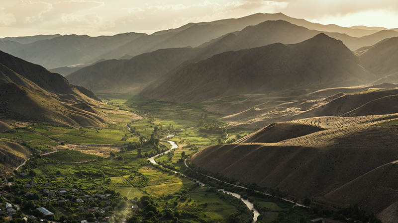
Places too see in Vayots Dzor. Vayots Dzor is the smallest region in Armenia, but the richest in the number and variety of sights. Here you will find wonderful contrasting landscapes and rich historical monuments.
In this article we will present 15 places too see in Vayots Dzor.
Agarakadzor Bridge
Distance from from Crossway Camping 3.5km
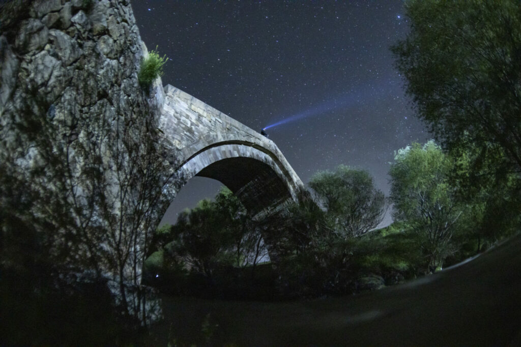
Agarakadzor Bridge is located in the Vayots Dzor province on the Arpa River, opposite the town of Yeghegnadzor. It was built in the 13th century. This one-span structure, built purely by hewn stones of light color on the lime mortar, the edging of the archway is composed of dentate wedge-shaped stones. The bridge operated until the 1970s. With the passage of time, the foundations of the bearing arches of the bridge were shaken under the influence of climatic conditions. In the years 1985-1986 the works on strengthening were carried out, however, after that it is not designed for operation by its vehicles.
Areni Cave
Distance from from Crossway Camping 11km
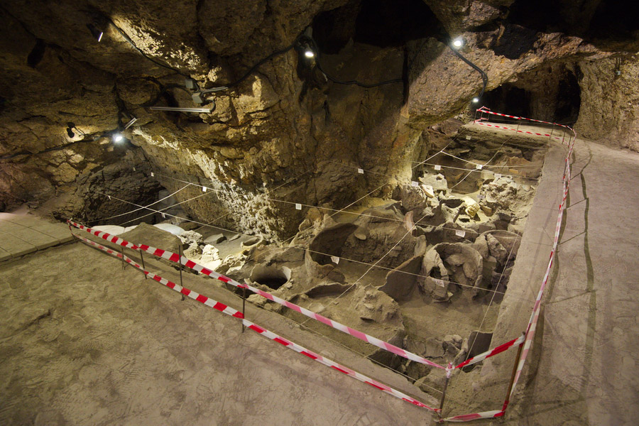
Areni Cave is a multicomponent cave site with artifacts dating from the Chalcolithic to the Bronze Age. The complex is also known as “Birds’ Cave” (“Trchuneri” in Armenian). Located near the village of Areni, which lies close to the Arpa River and the Gnishik River: Several unbelievable items were found in this cave. In 2010, the oldest shoe (more than 5500 years old) was found here; in 2011–one of the first wineries in the world (= about 6000 years old); and in 2011– a woman’s skirt, dated around 3900 B. C.
The cave has an entrance fee, where you can use the services of a guide.
Bezoar goats observation point in Shatin
Distance from from Crossway Camping 11km
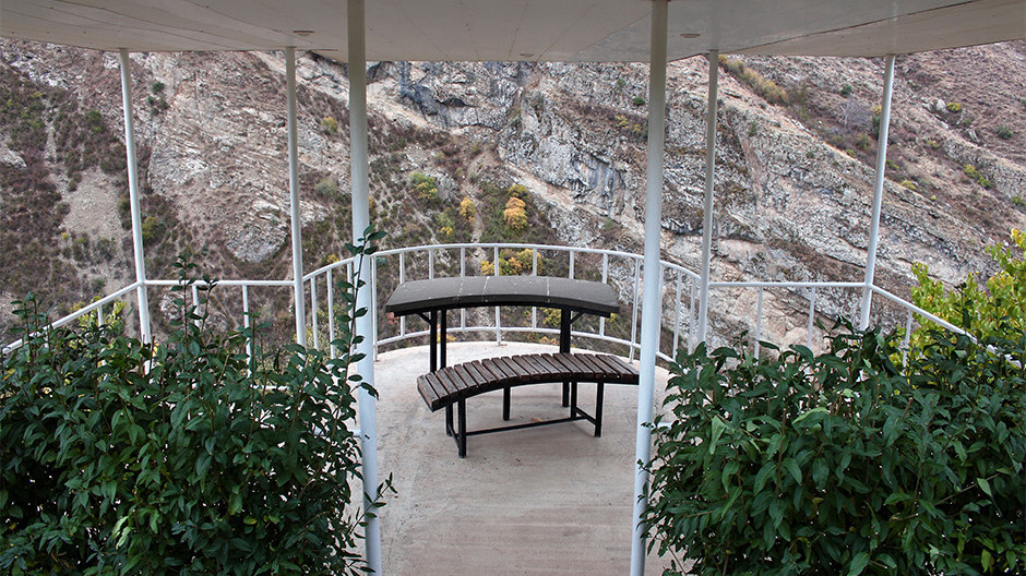
In the evening, bezoar goats pass right here. If you are lucky, you can see several groups of these animals at once.
Areni village and mudslide dam
Distance from from Crossway Camping 13km
Areni village is one of the most popular villages for wine lovers, there are many families here who produce their own wine. Here you can taste delicious wines and visit St. Astvatsatsin Church in Areni (1321). An interesting structure is the mudslide dam located 2 km away from the village. It was built during the Soviet era to protect the village from mudslides in the mountains.
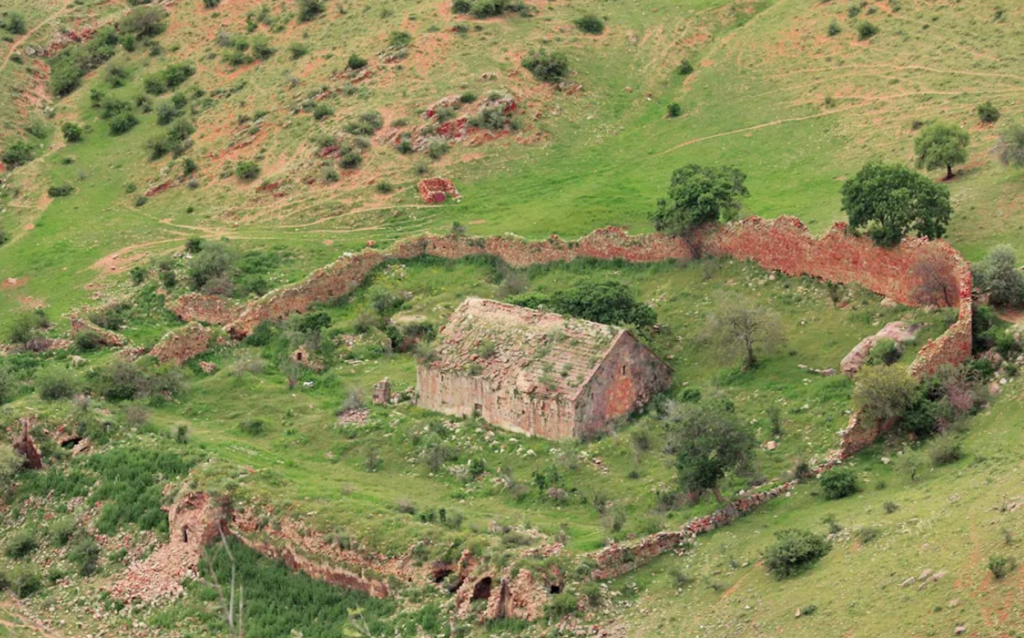
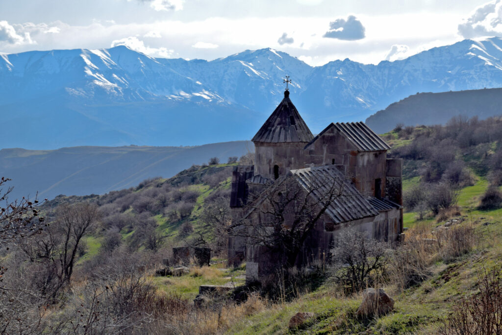
Spitakavor Monastery
Distance from from Crossway Camping 16.3 km
Spitakavor Monastery is located on the slopes of Teksar mountain, 7 kilometres north of Vernashen village of the Vayots Dzor Province. The terrain is difficult, but the monastery can be reached on foot or with an all-terrain vehicle. It is about 8.4 kilometres from the University of Gladzor’s Museum and Tanahat Monastery and about 6 kilometres to the Proshaberd fortress.
Spitakavor Monastery was built by two princes from the Proshian dynasty during the Zakarid Armenia period. The construction of the church began by Prince Eachi (died in 1318) and completed in 1321 by his son Prince Amir Hasan II. Between 1321 and 1330, the narthex was built, and in 1330 Hovhannes Proshian and his wife, Tadzna, added a three-story bell-tower to the western wall of narthex. This Monastery is one of the best places too see in Vayots Dzor .
You can reach the monastery either by SUV or on foot
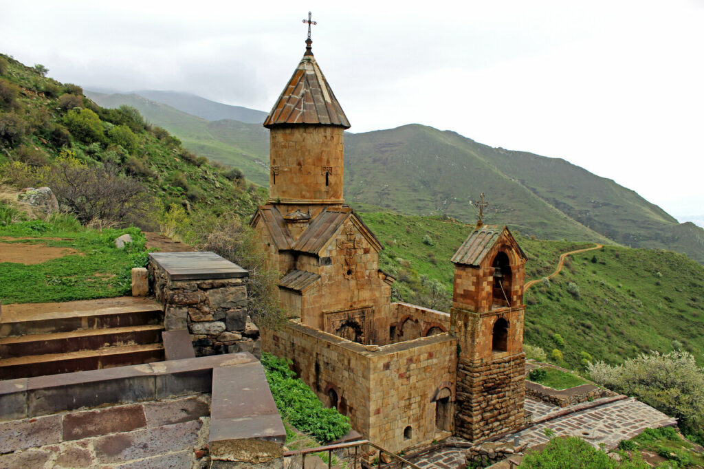
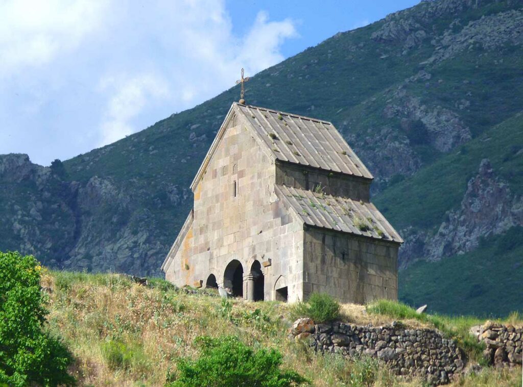
Shativank monastery
Distance from from Crossway Camping 16.6 km
Shativank or Shatik Anapat, Shatin monastery, this is the name of the monastery located 4 km east of Shatin village of Vayots Dzor region. The monastery was built in 922. During the reign of King Abbas I Bagratuni, Prince Smbat և Bishop Hakob of Syunik.
Noravank Monastery
Distance from from Crossway Camping 18.5 km
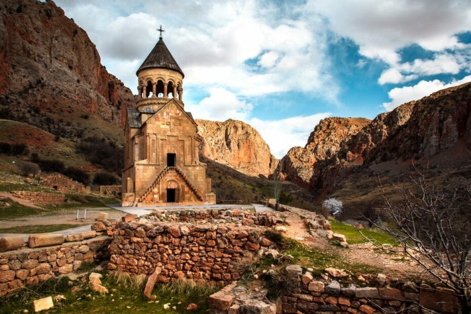
One of the best places too see in Vayots Dzor is Noravank Monastery is situated on a ledge of a deep winding gorge of a tributary of the Arpa River near the village of Amaghu in Vayots Dzor region. The gorge is known for its tall, sheer, brick-red cliffs, directly across from the monastery. Noravank Monastery is best known for its two-story Surb Astvatsatsin (Holy Mother of God) church, which grants access to the second floor by way of a narrow stone-made staircase jutting out from the face of the building, one of the earliest examples of cantilever architecture.
Hiking lovers can reach Noravank through the Gnishik Protected Area, located in the highlands of Noravank Gorge.
Zorats church
Distance from from Crossway Camping 18.6 km
Zorats church was dedicated in 1303 by archbishop Stepanos- a grandson of Prince Tarsaiyich Orbelian, whose castle was in Areni. At the time, Armenia was a tributary of the Mongols (ca. 1242-1344), Armenian lords and troops requisitioned to fight against the Mamluks and renegade Turko-tribes vying for the kingdom’s rich lands. Zorats church was created so that warriors sitting on their horses could receive the sacrament and the blessing of the Church before going to battle. The blessing of troops and their horses before battle were commonplace, but no other church in Armenia was built exactly for that purpose, and with the idea of bringing both steed and soldier into the outdoor sanctuary.
The church can be reached by car, and it is a great destination for light walking lovers.
Tsaghats Kar Monastery
Distance from from Crossway Camping 18.6 km
Visiting this monastery is mainly combined with Smbataberd. Tsaghats Kar Monastery is a monastic complex located along the mountain foothills overlooking the Yeghegis River, between the villages of Yeghegis (6 km northeast) and Horbategh in the Vayots Dzor Province of Armenia. The monastery is located within walking distance of the fortress of Smbataberd.
There are two groups of structures at the site that are separated by a distance of 200 meters (656 feet). The grouping to the west, now half-ruined, was constructed of rough-hewn basalt.
Smbataberd Fortress
Distance from from Crossway Camping 21 km
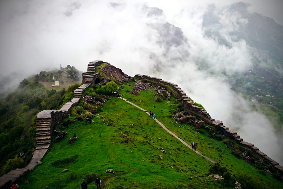
Smbataberd Fortress is located in the Vayots Dzor region and is considered one of the largest medieval fortresses in the region. The Fortress lies to the southeast of Artabuink village on top of a narrow mountain top. From here you can also see the village of Yeghegis. On three sides the Fortress is protected by the ridge. The wall made it impregnable for most of its life, the mountain is approached only on its north end.
The Fortress dates to the 10th-11th centuries, probably built during the reign of the Bagratuni king Smbat II Tiezerakal (“Master of the Universe”), when Armenia built a number of fortified complexes (including monasteries).
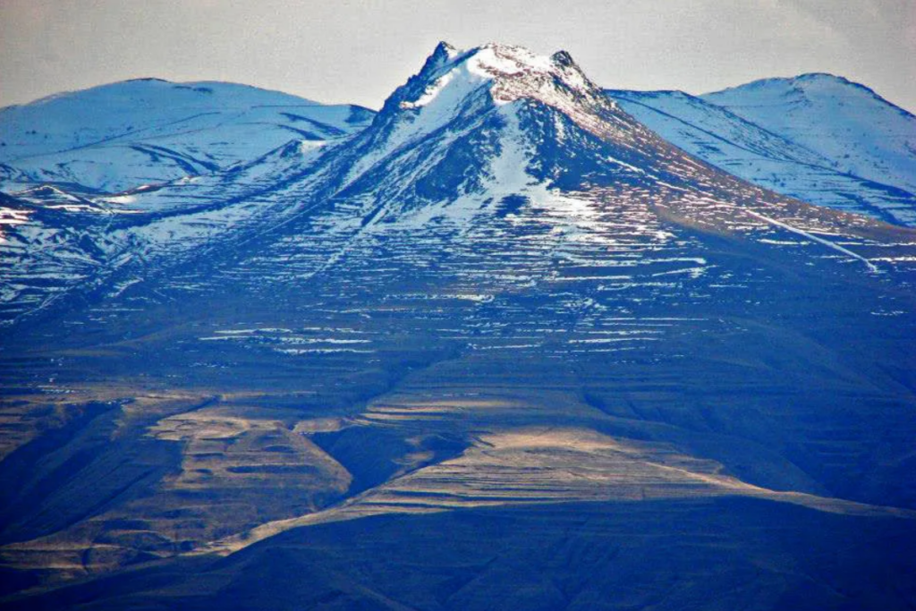
Vayotsar Mountain
Distance from from Crossway Camping 22.6 km
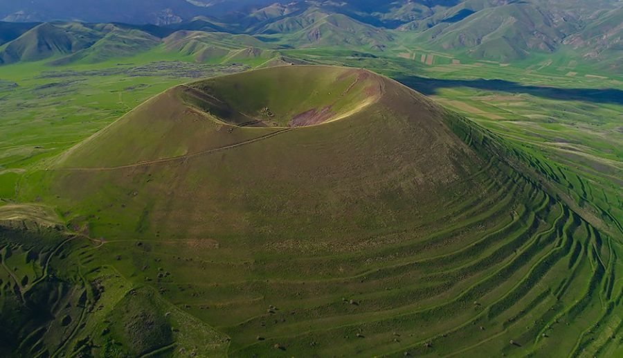
Vayotsar Mountain (2581 m.) is located in Vayots Dzor, 6 km northwest from the village Herher (1680m). It is a dormant volcanic mass with a 125-meter-deep summit crater. Due to its peculiar look, the mountain is one of the most favorite destinations among Armenian mountaineers. The crater and the concavities are so proportionate that they seem to be outlined by a human’s hand.
You can reach the foot of the mountain by SUV, and hiking lovers can start walking from Herher village.
Vardablur Mountain (Wolf Ears)
Distance from from Crossway Camping 24 km
Mount Vardablur is also known as Wolf Ears. There are roads to the foot of the mountain, which can be reached by car (SUV is advisable), and in case of starting the ascent from the villages, it is expedient to walk from Zedea village, as the distance from the village to the top is 4.82 km, and from Agarakadzor village – 12.68 km.
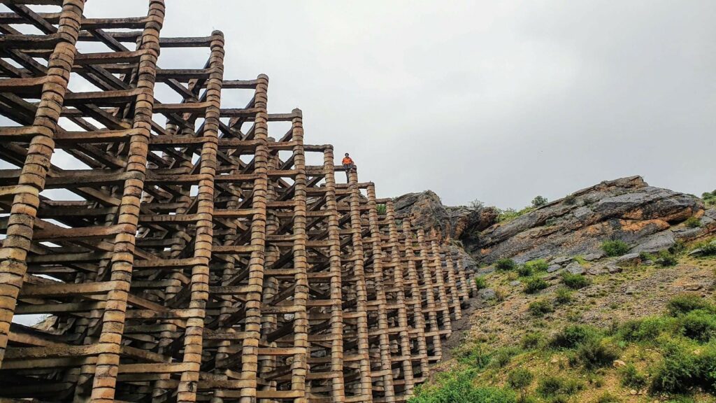
Orbelian’s Caravanserai
Distance from from Crssway Camping 30.8 km
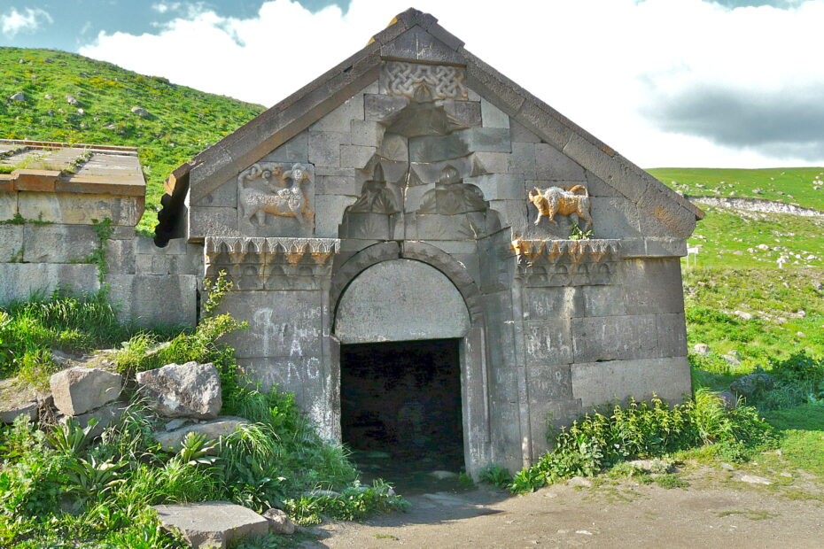
Orbelian’s Caravanserai is a caravanserai in the Vayots Dzor Province of Armenia. It was built along the Vardenyats Mountain Pass in 1332, by prince Chesar Orbelian to accommodate weary travelers and their animals as they crossed from, or into, the mountainous Vayots Dzor region. Located at the southern side of Vardenyats Mountain Pass at a height of 2410 meters above sea level, Orbelian’s Caravanserai is the best preserved caravanserai in the entire country. Ruins of a small chapel may still be seen adjacent to the vestibule, across the road from a spring.
Artavan Lake
Distance from from Crossway Camping 37.5 km
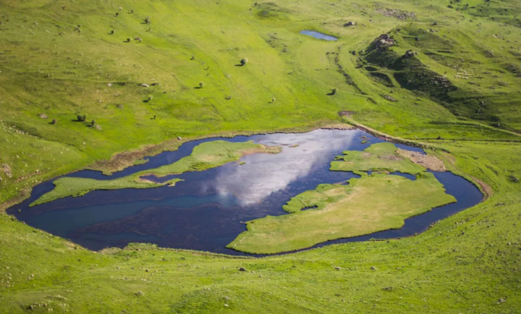
Next place of our blog ” 15 places too see in Vayots Dzor “: Artavan Lake is located 2.5 km northeast of the village of Artavan in the Region of Vayots Dzor. At an altitude of 2240 m above sea level. Looking like a map of the world from above.
Jermuk Waterfall (Mermaid Hair Waterfall)
Distance from from Crossway Camping 51 km
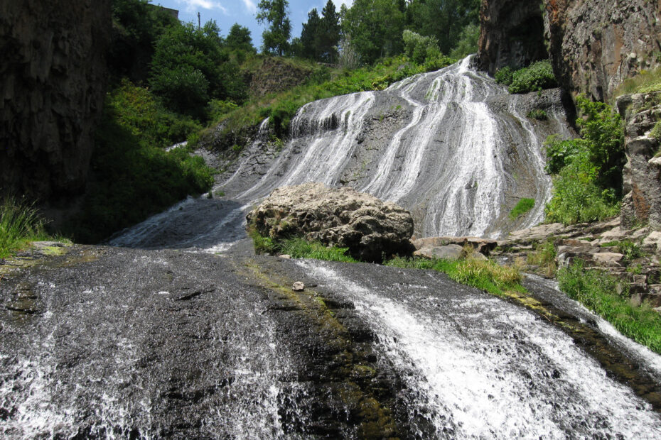
Mermaid Hair Waterfall is located in Jermuk. It is 72 m high. It slopes into the Arpa River, resembling a girl’s hair, hence its name. In Jermuk you can also visit Jermuk Mineral Water Drinking Hall, a park near the statues of Hayduk անդ Jermuk Gallery.
You can get acquainted with the larger list of places too see in Vayots Dzor here: Vayots Dzor sights.
This article ” 15 places too see in Vayots Dzor ” is copyrighted by campinginarmenia.com. The content of the article can be quoted, used on other sites, only with an active link to the source.